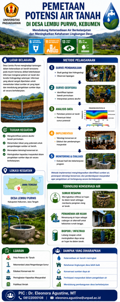
INTEGRATING GROUNDWATER POTENTIAL MAPPING AND APPROPRIATETECHNOLOGY-BASED WATER SCREENING SYSTEMS TO ENHANCE CLEAN WATER RESILIENCEAND CLIMATE ADAPTATION IN LEMBU PURWO VILLAGE, KEBUMEN, CENTRAL JAVA, INDONESIA

Widy
UNPAD Staff Writer



Strengthening Clean Water Resilience through Community-Based Research in Lembu Purwo Village (2026-2028)
By Dr. Eleonora Agustine, M.T., Dr. Aziiz Mardanarian Rosdianto, S.Kep., Ners., M.H.(Kes.), M.Si., AIF, Dr. Kasno Pamungkas, S.S., M.Hum., and Dr. Ir. Raden Irvan Sophian, S.T., M.T.
As part of its commitment to sustainable community development and climate resilience, Universitas Padjadjaran conducted a multidisciplinary community-based research and engagement program in Lembu Purwo Village, Kebumen Regency, Central Java, Indonesia, from 26–28 June 2026. The program addressed the growing challenges of groundwater scarcity and the deterioration of water quality associated with seasonal droughts and climate variability.
The initiative integrated geophysical investigation, hydrogeological assessment, environmental monitoring, and community participation to strengthen local clean water resilience. The research focused on identifying groundwater potential through remote sensing analysis and field-based hydrogeological observations, while simultaneously evaluating water quality using scientific screening methods and appropriate water treatment technologies. This integrated approach provides a robust scientific basis for sustainable groundwater management and supports evidence-based decision-making for rural water resource planning.
Field activities included public education on water conservation and environmental health, groundwater sampling, physicochemical water quality assessment, environmental surveys, soil temperature measurements, and satellite-based remote sensing analyses to evaluate land cover dynamics and their influence on groundwater recharge and hydrological conditions. The collected datasets will contribute to a comprehensive understanding of local groundwater systems and support the development of adaptive strategies for mitigating water-related risks under changing climatic conditions.
Beyond generating scientific evidence, the program emphasized community empowerment by enhancing local capacity in water resource stewardship and promoting environmentally responsible practices. The integration of geophysical techniques with community-based research demonstrates how interdisciplinary approaches can improve water security, strengthen climate adaptation, and foster long-term environmental sustainability in rural communities.
This initiative directly contributes to the United Nations Sustainable Development Goals (SDGs), particularly SDG 3 (Good Health and Well-being) through improved access to safe drinking water, SDG 6 (Clean Water and Sanitation) by promoting sustainable groundwater management and water quality protection, and SDG 13 (Climate Action) by strengthening community resilience and adaptive capacity to climate-induced water resource challenges.